Arctic System Science Thermokarst Project (ARCSSTK);
spatial and temporal influences of thermokarst failures on surface processes in arctic landscapes, for more information on the ARCSS project click here)
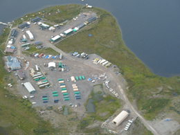
This research was conducted in the vicinity of the Toolik Field Station (TFS, N68° 380, W149° 360), which is approximately 255 km north of the Arctic Circle and at an average elevation of 720 m above sea level in the foothills province of the Brooks Range, AK.
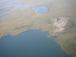
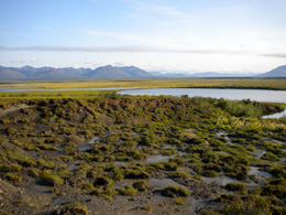
In the area around Toolik, we study how disturbances caused by thermokarsts (uneven terrain, erosion, and sinkholes created when permafrost thaws) affect landscape-scale carbon, nitrogen and phosphorus (CNP) pools. We characterized losses of CNP stocks during disturbance and their recovery after disturbance. The study of thermokarst features can also lead to a better understanding of how tundra vegetation responds to disturbance and provides evidence of succession pathways (i.e., transformation of graminoid tundra to shrub tundra). Three thermokarst chronosequences were used to characterize vegetation and soil CNP loss and recovery. The mode of permafrost degradation associated with these chronosequences fit the description of a retrogressive thaw slump (RTS) as defined by Jorgenson and Osterkamp (2005). Two of these RTS (NE14 and the Itkillik series) are surrounded by non-acidic, non-tussock sedge, dwarf shrub, moss tundra. The third RTS (I-minus1) is surrounded by acidic, tussock sedge, dwarf shrub, moss tundra on top of wet sedge peat.
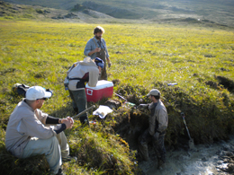
Field sampling consisted of collecting permafrost soils to determine pools of CNP that could be mobilized during thaw and thermokarst activity. We also ran 50m linear transects inside and outside of thermokarst features for vegetation percent cover, aboveground biomass estimates, shrub density, soil temperature, and thaw depth.
 |
 |
Aerial view of a thermokarst (credit: A. Baron) |
Toolik field station (credit: A. Baron) |


